Summary: Latitude Vs. X
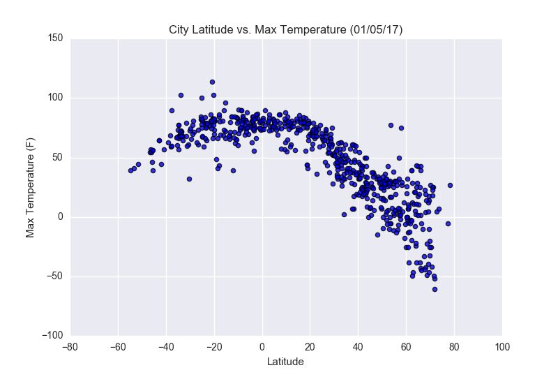
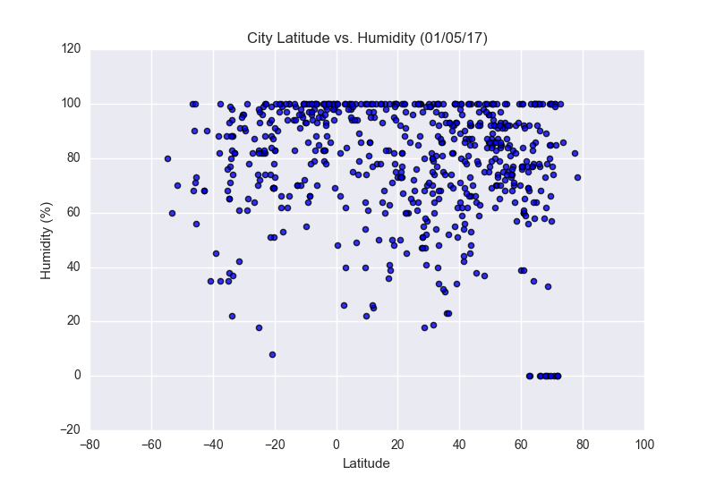
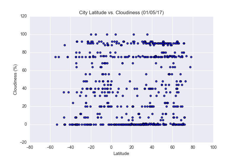
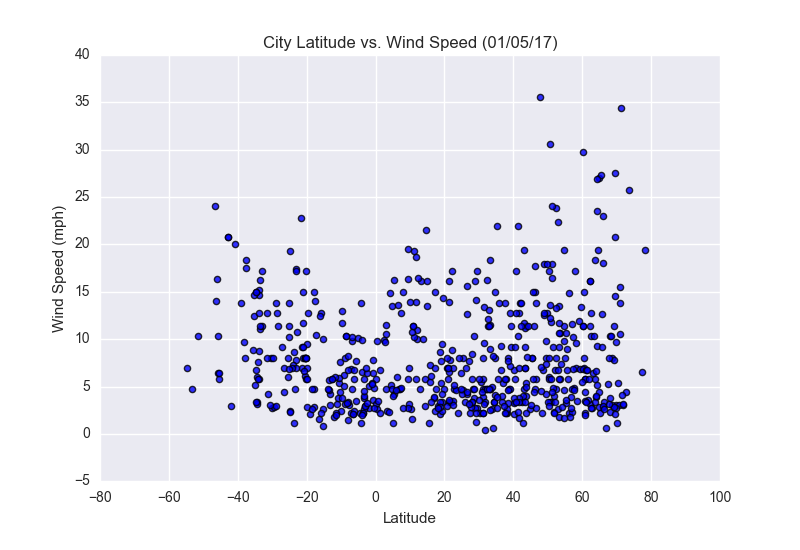
The purpose of this project was to look at the changes in weather in differing latitudes. We generated 500+ random cities orldwide and looked at their max temperatures, humidity levels, cloudiness percentage and wind speeds. Then plotted the results for all of the countries and analyzed the trends.
The second part of the project was to create a heat map of the cities using their humidity percentage from the list in the first part. We then narrowed the cities down to those that fit a certain criteria. And lastly used Google Places API to generate hotels that were within 5000 meters of the narrowed list and drop a marker.
Visualizations